 |
| ||||||||||||||||||||||||||||||||||
Blog Entry# 141357
Posted: Apr 18 2011 (16:59)
8 Responses
Last Response: Apr 18 2011 (17:45)
8 Responses
Last Response: Apr 18 2011 (17:45)
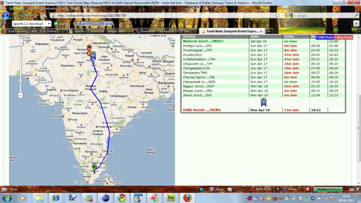
In Rail map section, the rail map is shown according to the stoppages. Here, I am attaching a pic, according to which TN SK passes through sea.
I understand it is not easy to plot the map easily, but if we can generate some stations in between (not visible to anyone else) for proper route mapping, then it could help people better.
4 Public Posts - Mon Apr 18, 2011
3 Public Posts - Mon Apr 18, 2011
Travel SAFE
1. RailFanning does NOT MEAN dangerous pics/videos.
2. Doorplating pics/youtube videos are strictly FORBIDDEN in IRI.
3. Take plenty of food pics and other safe pics.
4. Write human interest narratives to make the pics interesting.
5. Enjoy blogging and travelling SAFELY.
REMEMBER: YOUR LIFE is the most precious thing, NOT RailFanning.
Scroll to Top